Directions to the Fitness First Stadium…
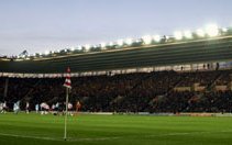
The Stadium
The Fitness First stadium was opened in 2001 and is placed exactly where the old ground used to be situated ( just rotated 90 degrees).
The Stadium is all seater and covered, with the exception of the newly opened South Stand.
Away fans are housed in half of the East Stand which runs alongside the pitch.
How to get there by car
From the M3 – take the M27/A31 to just past Ringwood. At the relatively new Ashley Heath interchange, get on the left hand lane, then come off and go left down the A338 Bournemouth Spur Road to Bournemouth.
From the M4 – at junction 15, come off the A345 to Marlborough and stay on this road, via Salisbury and Ringwood on the A338. Then, take the A31 to Bournemouth. 500 metres later, take left hand lane for the A338 to Bournemouth. (Alternatively, there is a route via the M3 and M27 via Newbury and Winchester)
From the West – take the A35 from Dorchester. At Bere Regis, take the A31 to Wimborne and turn right at Ashley Heath interchange onto the A338.
From the North and Midlands – head towards the M40. It will take just under two hours from Cherwell Valley Service station on the M40 at junction nine. Take the next exit towards Oxford and follow signs to Newbury. Just North of Newbury, you will meet a roundabout connecting the M4. Continue South and follow directions posted further up the page.
From the East – (north of London), head towards the M25 and then take the turn-off at the M3. Follow subsequent directions above from there.
As you approach Bournemouth, go over the Cooper Dean flyover (just after the ‘welcome to Bournemouth’ sign). You’ll see a big sports complex (the Littledown centre) to your left together with a large green glass building (JP Morgan HQ). You want to take the next junction off the A338 (sign posted – football traffic).
Parking
Parking on residential streets immediately around the stadium is restricted with yellow cones and you’ll likely to end up with a ticket if you plonk your car there.
A large car park right next to the stadium is available. You do have to buy a ticket though (no free time in the evening) as again, you could end up with a hefty fine.
On street parking is available further away from the ground.
Travelling by train
The nearest station is at Pokesdown (opposite the Bell pub) although not all trains stop there. Bournemouth is only a mile further away from the stadium and a twenty-minute walk from the ground.
As you come out of Pokesdown station, turn right and walk up towards Boscombe. Take a right into Gloucester Road (3rd on your right) and follow the street until it leads you into Kings Park. You should be able see the ground from there.
From Bournemouth Central Station, walk towards the main road by Asda (Holderhurst Road) and then turn left, and follow that road (over the small roundabout) for about a 15 minutes. Walk past the Dolphin and Queen’s Park Pubs. As you pass a small roundabout by a telephone box on the corner, cross the road, keep walking ahead and then take the first right into Thistlebarrow Road.
Travelling by bus
Boscombe bus station is about 10 minutes walk from the ground. Buses from Bournemouth town centre (and the train station) and from further afield stop in Boscombe.
Thanks to Paul Williams from rednblack.net for the travel information.